Ecological corridors are not a planning constraint, but the most strategic investment in the resilience, security, and long-term value of our territories.
- They drastically reduce human-wildlife collisions, transforming an expense into a public safety gain.
- Every plot, even private ones, is an essential piece of a living infrastructure that preserves the genetic capital of wildlife.
Recommendation: Evaluate the potential of your own land as a link in this vital network, because the survival of ecosystems begins at the property scale.
The scene is sadly familiar on Canada’s roads: an animal lying on the asphalt, a victim of the brutal encounter between nature and our expansion. This direct impact is only the visible part of a much deeper problem: habitat fragmentation. In the face of urban sprawl encroaching on natural spaces, the conventional response has long been to think in terms of “protecting” isolated zones. We talk about creating sanctuaries, planting trees, or building “green bridges” for animals to cross highways. These solutions are useful, but they only treat a symptom and lack a big-picture vision. They perpetuate the idea of a separation between “our” world and “theirs.”
But what if the real key wasn’t to build bridges between islands, but to understand that the entire territory is an interconnected network? What if every planning decision, every municipal regulation, and even the management of a simple backyard were an opportunity to strengthen this living web? This is the shift in perspective proposed by the ecological corridor approach. It is no longer about seeing nature as a series of parks to be preserved, but as a living infrastructure, as essential to the prosperity of our communities as our road or electrical networks. It is a vision where the urban planner, the land manager, and the landowner are no longer managers of constraints, but architects of a resilient territory.
This article goes beyond the concept of a highway for animals. It dissects this systemic vision by exploring how large-scale interventions, like ecoducts, and actions at the property scale, like a simple hedge, fit together to form a coherent whole. We will see why isolation leads to extinction, how seemingly minor planning errors have cascading consequences, and what concrete tools—from conservation easements to simple ponds—allow one to become a key player in this great reconnection.
To navigate through this connected vision of land use planning, this guide explores the multiple facets of ecological corridors, from large-scale engineering to citizen action.
Summary: Building Tomorrow’s Living Network
- Ecoducts and wildlife crossings: why investing in animal bridges saves human lives?
- Windbreak hedges: how your backyard can serve as a highway for small mammals?
- Why do isolated populations eventually go extinct through inbreeding?
- The mistake of cutting a forest in two for a power line without mitigation measures
- Conservation easements: how to protect a corridor across multiple private lands?
- Silver, cross, or red: why do foxes from the same litter have different colors?
- The mistake of filling a “mud hole” on your land without a municipal permit
- Why can the disappearance of a single species cause an entire Quebec ecosystem to collapse?
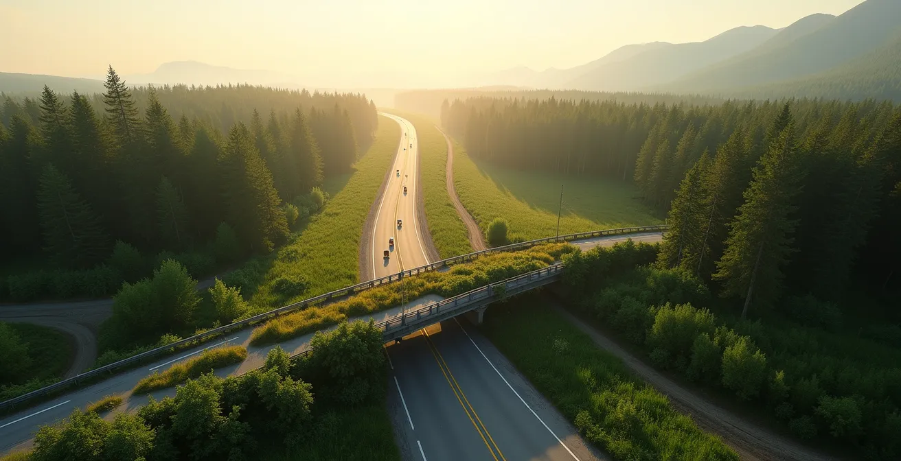
Ecoducts and wildlife crossings: why investing in animal bridges saves human lives?
When ecological corridors are mentioned, the image that often comes to mind is a verdant bridge spanning a highway. These structures, called ecoducts or wildlife crossings, are much more than a luxury for wildlife; they are a strategic investment in public safety. Every road that cuts through a natural habitat creates a potentially deadly conflict zone for both animals and drivers. The cost of collisions with large wildlife, in terms of property damage, injuries, and human lives, is considerable. Thinking of these passages as a mere expense for biodiversity is a calculation error. They are, in reality, road safety infrastructure.
The effectiveness of these developments is well-proven. Banff National Park in Alberta, a pioneer in the field, is a world-class case study. A study on wildlife crossings in Banff National Park reveals that more than 218,000 animal crossings have been recorded since 1996, demonstrating their massive adoption by dozens of species. Even more importantly for planners and municipalities, Parks Canada confirms that these structures reduce the risk of animal-vehicle collisions by more than 80%. This argument is decisive: an ecoduct is not a net cost, but an investment that generates a direct return in lives saved and avoided insurance and healthcare costs.
These large-scale projects show that planned ecological connectivity on a large scale is a win-win solution. They transform a deadly barrier into a safe passage, restoring migration routes and simultaneously protecting human and animal populations. For an urban planner, integrating such structures into the planning of new transportation infrastructure is no longer an option, but a necessity for creating a territory that is both functional and safe.
Windbreak hedges: how your backyard can serve as a highway for small mammals?
If ecoducts represent the backbone of ecological corridors, private lands are the capillary nervous system. The vision of a connected territory cannot rely solely on large public projects. It depends on the sum of a multitude of small actions at the scale of individual property. Your backyard, however modest, is not an island; it is a potential piece of a vast territorial mosaic. A simple hedge of native shrubs, a strip of unmown vegetation at the edge of the lot, or a permeable fence can make the difference between a deadly dead-end and a vital passage for small mammals, birds, insects, and amphibians.
This idea of shared responsibility is at the heart of the success of ecological corridors. As Kateri Monticone, project manager for Ecological Corridors in Quebec, aptly puts it:
When I talk about an ecological corridor, I think of a jigsaw puzzle. Every piece is held by an actor in the territory. We must find a way for everyone to put a piece on the table, so that everyone sees the added value and everyone is proud to contribute to biodiversity.
– Kateri Monticone, Radio-Canada – Ecological corridors in Quebec
This puzzle metaphor is powerful for a landowner or urban planner. It transforms a perceived obligation into a rewarding contribution. Landscaping your property with “connectivity” in mind does not mean turning it into a wild wasteland. It’s about intelligently integrating natural elements that facilitate wildlife movement. Grouping living areas (terrace, pool) on one side of the lot to leave a vegetated “right of way” on the other is a simple and effective strategy. Considering limiting night lighting, which disorients and fragments, is another high-impact action.
Your roadmap for a welcoming garden: audit your land’s potential
- Inventory of crossing points: Identify all potential entry and exit points on your land (under fences, discontinuous hedges). Are they safe and connected to neighboring properties?
- Analysis of barriers: List all impassable barriers (solid fences, low walls, buildings). Is it possible to create an opening (a “hedgehog highway”) or plant a vegetation strip to bypass them?
- Mapping of refuge zones: Identify areas of dense vegetation cover (shrub thickets, wood piles, tall grass). Are they connected to each other to allow movement sheltered from predators?
- Resource evaluation: Does your land offer water (pond, birdbath) and food (native plants producing berries and seeds)? Are these resources accessible?
- Action plan for connectivity: Based on this audit, define 2-3 priority actions to link crossing points, refuges, and resources, thereby creating a functional mini-corridor on your plot.
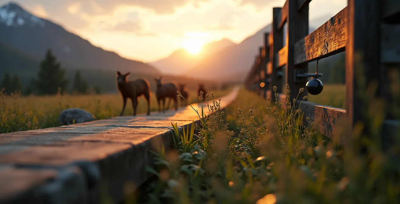
Why do isolated populations eventually go extinct through inbreeding?
When a highway, a residential neighborhood, or an agricultural field cuts a forest in two, it doesn’t just reduce the habitat area. It creates islands. On these biological islands, animal populations find themselves trapped, unable to mix with their peers. In the short term, this limits access to resources. But in the long term, the danger is far more insidious and invisible: genetic collapse. Without the contribution of “new blood,” the genetic diversity of the population dwindles with each generation. Individuals are forced to reproduce with close relatives, a phenomenon called inbreeding depression.
The consequences are disastrous. Inbreeding increases the frequency of genetic defects, reduces fertility, weakens the immune system, and decreases the population’s ability to adapt to changes (diseases, climate variations). An isolated population gradually loses its “genetic capital” and becomes increasingly fragile, until local extinction occurs. It is a silent countdown. In Quebec, the case of the Western Chorus Frog in Montérégie is a tragic example of this process. Fragmented by urbanization, its population has suffered, according to government data, a decline of 37% per decade since 1950.
In the face of such a critical situation, scientists must sometimes resort to extreme solutions that clearly illustrate the failure of upstream planning.
Case Study: The Genetic Rescue of the Western Chorus Frog
Faced with the collapse of populations in Montérégie, biologists launched a last-resort operation. They captured dozens of frogs in the few remaining pockets of survival to bring them to the Montreal Biodôme. There, in a kind of “assisted reproduction clinic” for amphibians, they organize controlled breeding to maximize the genetic diversity of the offspring. These are then reintroduced into protected habitats. This intervention, while remarkable, is a costly and complex bandage on a wound that could have been avoided. It highlights the cost of inaction: when natural corridors disappear, we must artificially recreate the genetic mixing they once provided for free.
Ecological corridors are therefore the antidote to inbreeding. They act as genetic bridges, allowing individuals from different populations to meet and reproduce, thereby maintaining a healthy and diverse gene pool, essential for the long-term survival of any species.
The mistake of cutting a forest in two for a power line without mitigation measures
For a planner, routing new linear infrastructure—a road, a pipeline, or a high-voltage power line—is a complex optimization exercise. However, a purely technical or economic vision that ignores the impact of fragmentation can prove to be a costly mistake in the long run. Cutting a forest block in two without providing measures to maintain connectivity is to willfully create the isolation problem described above. But the mistake is seeing the infrastructure’s right-of-way as a problem, when it could become part of the solution.
A power line right-of-way, for example, must be kept clear of tall trees. But instead of leaving it as bare earth or managing it with herbicides, it can be transformed into an active vegetative corridor. By planting native shrubs, flower meadows, and other low-growing plants, a perfect habitat and passage route are created for many species: pollinators, small mammals, and open-habitat birds. The energy transport infrastructure then becomes, through intelligent management, a biodiversity transport infrastructure. This proactive approach transforms a maintenance constraint into an ecological opportunity.

This strategic vision is already being implemented in large-scale projects. The Cabinet-Purcell Mountain Corridor initiative, on the border of British Columbia, Alberta, and the United States, is an excellent example. This project aims to reconnect a landscape crucial for large mammals like grizzly bears and wolverines, fragmented notably by Highway 3. By combining land acquisition, conservation easements, and the development of crossings, the project partners are not just “repairing” fragmentation; they are planning for the resilience of a transboundary ecosystem in the face of future pressures. They treat the landscape as an integrated system, where every element, including human infrastructure, has a role to play in global connectivity.
Conservation easements: how to protect a corridor across multiple private lands?
Most land in southern Canada is privately owned. The creation of functional ecological corridors cannot, therefore, depend solely on action on public lands. How then can the permanence of a corridor that crosses a mosaic of private properties be guaranteed? The answer lies in a powerful legal and fiscal tool: the conservation easement. This is a voluntary agreement between a landowner and a recognized conservation organization (such as a municipality or a land trust). Through this agreement, the owner agrees to restrict certain uses of their land to protect its ecological features, in perpetuity.
Unlike expropriation or a purchase, the owner retains their title to the property and can continue to live on and use their land, as long as the activities comply with the terms of the easement. For a corridor, this could mean an agreement not to build within a 30-meter strip along a stream, or not to clear a wooded plot that connects two forests. When several neighboring owners sign such easements, they collectively weave a permanent and legally protected corridor. It is a very long-term planning tool that transcends changes in ownership.
The incentive for owners is far from negligible. The Government of Canada, through the Ecological Gifts Program, offers significant tax benefits. As explained by the National Capital Commission, the body that manages this program: “The Ecological Gifts Program offers Canadians with ecologically sensitive land the opportunity to protect nature and leave a legacy for future generations. Under Canada’s Income Tax Act and the Quebec Taxation Act, it provides significant tax benefits.” This “donation” of usage rights is considered a charitable gift, giving the right to a tax credit based on the ecological value of the protected land. For an owner, it is a way to protect their natural heritage, leave a lasting legacy, and benefit from a concrete financial advantage.
Silver, cross, or red: why do foxes from the same litter have different colors?
The presence of several coat colorations within the same species, as in the red fox which can be silver, cross, or classically red, is a visible sign of good genetic health. This diversity of traits is the expression of a wide range of genes within the population. It is this same genetic richness that allows species to adapt to changes in their environment. A gene coding for a darker coat may be advantageous in a dense forest habitat, while another will be more effective in an open environment. Connectivity between populations, ensured by corridors, is what allows these different genes to circulate and be maintained in the global gene pool.
Today, this capacity for adaptation is more crucial than ever, as species face an unprecedented challenge: climate change. Habitats are transforming and species’ ranges are shifting. In Canada, a generalized movement of wildlife toward higher latitudes and higher altitudes is observed to follow the climatic conditions to which they are adapted. Studies show that, on average, animals move north at a rate of about 45 km per decade. This great migration can only happen if the landscape is sufficiently permeable.
In this perspective, ecological corridors change status. They are no longer just lateral connections between existing habitats, but climate migration highways oriented north-south. They become the essential infrastructure that will allow biodiversity to adapt and reconfigure in the face of warming. For a planner or urbanist, planning corridors today means anticipating the needs of tomorrow. It means designing a network that will allow not only local populations to survive but also the wildlife of tomorrow, arriving from the south, to find refuge on our territory. It is an act of visionary planning that ensures ecological resilience at the scale of a continent.
The mistake of filling a “mud hole” on your land without a municipal permit
For a landowner concerned with the aesthetics of their property, a “mud hole”—that small depression that fills with water in the spring only to dry up in the summer—might seem like a nuisance to be eliminated. The common mistake is to fill it in to “clean up” the landscape. However, this action, often carried out without consulting the municipality, can be a local ecological catastrophe and may even be illegal. These temporary wetlands, or vernal pools, are habitats of capital importance for the reproduction of many amphibian species, including the Western Chorus Frog, a species now designated as threatened in Quebec.
Why are these small ponds so crucial? Their temporary nature is precisely their greatest asset. Because they dry up in the summer, fish—which are major predators of tadpoles—cannot establish themselves there. They therefore constitute a safe nursery for amphibian larvae. The loss of these habitats is the main cause of the decline of the Western Chorus Frog, of which it is estimated that 50% of populations have disappeared or are on the verge of disappearing. Every filled pond is a link in the reproductive chain that breaks. This is why filling any wetland, even temporary, is governed by provincial and municipal regulations. Acting without a permit means risking the destruction of an essential habitat and exposing oneself to sanctions.
The interconnection of these small water points is also fundamental. The Western Chorus Frog rarely moves more than 250 meters from its natal pond. Its survival therefore depends on a dense network of wetlands, a true “stepping stone” of ponds that allows it to move, feed, and maintain genetic mixing. For an urban planner, this means that protection should not focus on a few large marshes, but on preserving this mesh of small environments, including on private lands. The role of the municipality is then to inform citizens about the value of these “mud holes” and the regulations that protect them, transforming a negative perception into an awareness of their vital ecological role.
To Remember
- Ecological corridors are not an expense but an investment in public safety, drastically reducing road accidents.
- Every private property, through simple enhancements like a hedge or a permeable fence, is an essential link in the territory’s living infrastructure.
- Planning ecological connectivity today means building the migration routes that will allow wildlife to adapt to tomorrow’s climate changes.
Why can the disappearance of a single species cause an entire Quebec ecosystem to collapse?
In the grand architecture of life, every species, even the most modest, is an interdependent link. The idea that we can afford to lose a “little frog” without consequence is a deep misunderstanding of how ecosystems function. The disappearance of a single species can trigger a chain reaction, a “domino effect” that weakens, or even collapses, the entire local balance. This is the concept of the keystone species: its influence is disproportionate to its abundance. In Quebec, where there are more than 1,635 designated wildlife habitats to protect these links, the Western Chorus Frog is a perfect example of this interdependence.
As biologist Lyne Bouthillier points out, “the chorus frog is less visible than large threatened mammals like the beluga or the caribou, but it is just as important.” It feeds on insects, contributing to their regulation. It is itself prey for animals like raccoons or foxes, serving as a food source. Its disappearance would leave a void, affecting both the species it controls and those that feed on it. But its role goes further. Its presence is an indicator of the health of wetlands. And these environments provide us with countless free ecosystem services: water filtration, flood prevention, carbon sequestration. Protecting the frog by protecting its habitats is, therefore, protecting ourselves.
This is where the vision of ecological corridors takes on its full meaning. It forces us to move from “silo” thinking (saving a species, protecting a park) to “network” thinking. By ensuring the connection between habitats, we don’t just save a species from inbreeding; we ensure the functionality of the entire ecosystem. We guarantee that predators can find their prey, that pollinators can reach flowers, and that ecosystem services are maintained at the landscape scale. Every corridor is a life insurance policy for the territory’s resilience.
For urban planners, land managers, and landowners, it is time to see our territories no longer as surfaces to be optimized, but as living organisms to be connected. Integrating ecological connectivity into every decision is the next step, not only for the survival of wildlife but for building more resilient, safe, and sustainable human communities.
Frequently Asked Questions on how ecological corridors allow animals to survive urban sprawl?
Why protect a simple temporary pond?
These temporary ponds protect tadpoles from certain predators and are essential for the reproduction of many amphibians like the Western Chorus Frog.
What distance must a wetland maintain to be effective?
The Western Chorus Frog rarely moves more than 250 meters from its natal pond, requiring a dense network of wetlands.
How do I know if my land hosts this species?
Consult the map of occurrences of species at risk on donneesquebec.ca or contact your regional ministry office.